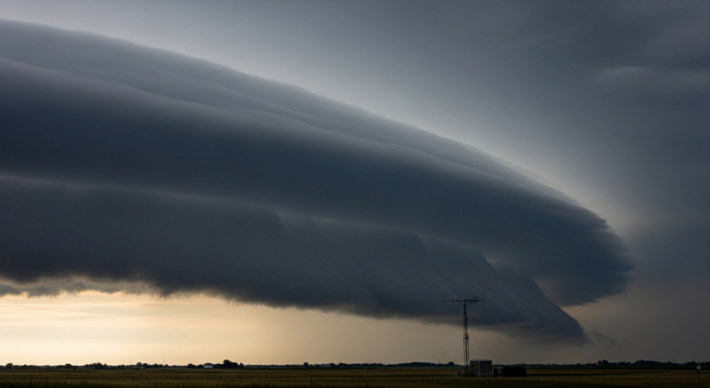
Severe thunderstorms are anticipated to develop across the northern Plains and extend into parts of the Upper Midwest on Sunday, June 28, 2026, according to independent weather-risk summaries. These advisories place a watch over outdoor activities planned for the day in affected regions.
The primary concerns identified in these non-federal forecasts are the potential for large hail and damaging straight-line winds. While tornadoes are not entirely ruled out, the risk is assessed as lower compared to the threats posed by hail and wind.
This outlook is particularly relevant for individuals and communities in the path of these developing weather systems, as it may impact travel, outdoor events, and general public safety. Residents and travelers in the affected areas are advised to monitor updated forecasts and advisories.
While this particular forecast focuses on the Northeast and Midwest, the underlying principle of monitoring severe weather risks is a constant consideration for public safety planning across the country. Local weather services often supplement these broader outlooks with specific, verified forecasts tailored to individual communities, providing context for local events and travel conditions. This allows for more precise preparation and response.
For Charleston, the primary concern stemming from such national weather patterns is often related to the potential for disruptions to regional travel, particularly air and road transportation, should severe weather systems track further south or impact major transit hubs. While direct impacts from these specific storms are unlikely in Charleston, awareness of broader weather trends can inform local preparedness for any potential ripple effects on supply chains or travel schedules.