Charleston, SC, August 18, 2025
News Summary
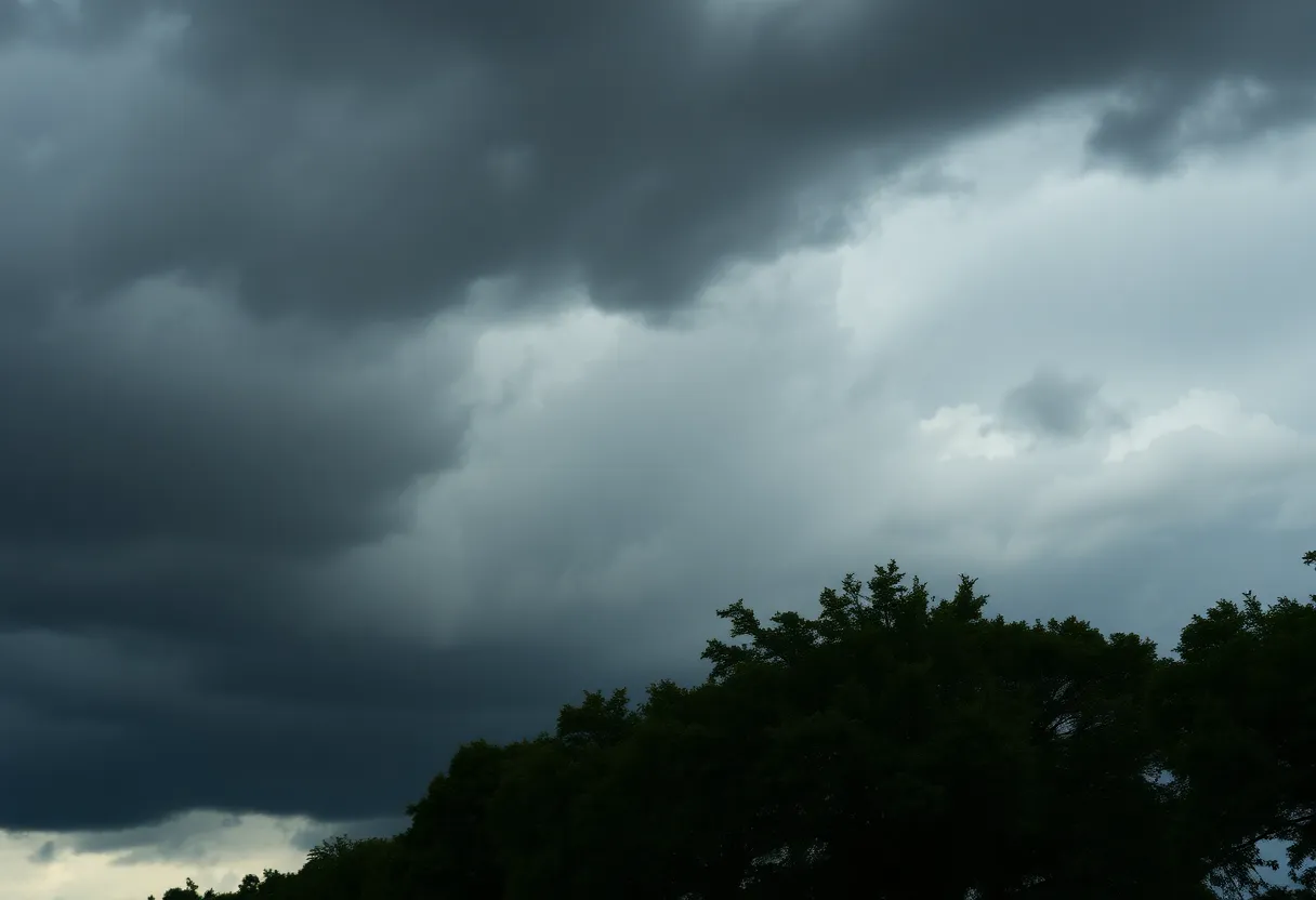
The National Weather Service has issued an updated severe thunderstorm warning for Dorchester and Charleston counties until 2 p.m. this Saturday. Residents should prepare for wind gusts of up to 50 mph and remain cautious. Doppler radar indicates strong thunderstorms moving through the region, particularly near Magnolia Gardens, which may lead to potential damage and hazardous conditions on the roads due to hydroplaning. The public is advised to stay informed through local news channels and weather updates.
Charleston, SC
An updated severe thunderstorm warning has been issued by the National Weather Service (NWS) in Charleston, SC, effective until 2 p.m. on Saturday. The warning encompasses both Dorchester and Charleston counties, with expected wind gusts approaching 50 mph.
At 1:30 p.m., Doppler radar indicated a strong thunderstorm near Magnolia Gardens, moving northwest at a speed of 15 mph. Residents in the affected regions should remain cautious as gusty winds from the storm could lead to tree limb damage and the displacement of unsecured outdoor objects.
The advisory specifically outlines several locations likely to be impacted by the storm, including:
- North Charleston
- West Ashley
- Johns Island
- Hollywood
- Ravenel
- Magnolia Gardens
- Red Top
- Rantowles
- Middleton Place
- Shadowmoss
Residents are encouraged to stay informed through NOAA Weather Radio All Hazards, local television, or news sources for the latest updates from the NWS.
According to statistics, approximately 25 million lightning strikes hit the U.S. each year, predominantly during the summer months. Tragically, annual lightning-related fatalities average around 20 individuals, a risk that increases significantly as thunderstorms approach, peaking when storms are overhead.
To ensure safety during thunderstorms, the NWS alert provides essential recommendations. One crucial safety concern involves hydroplaning, defined as the uncontrolled sliding of a vehicle when water accumulates underneath tires. Key factors contributing to this phenomenon include tire tread depth, speed, and water depth on roadways. Drivers are advised to be especially cautious under wet conditions to avoid accidents.
Further risk evaluations reveal ongoing severe storm threats in nearby counties. Recent observations indicate that the bulk of severe storms have moved out of the immediate area; nonetheless, isolated severe thunderstorms remain a possibility, leading to damaging winds that can cause significant harm to roofs, siding, and nearby trees.
Furthermore, storm damage reports and photographs can be submitted by residents to assist local authorities in addressing any issues stemming from the severe weather.
In relation to past alerts, it’s notable that the severe thunderstorm warning for Charleston, Berkeley, Dorchester, and Colleton counties officially expired at 10:45 a.m. on the same day. Previously, a tornado warning affecting Charleston, Colleton, and Beaufort counties was lifted shortly after 10 a.m.
Frequently Asked Questions
What should I do during a severe thunderstorm warning?
Stay indoors, clear areas of outdoor furniture or unsecured items, and follow local weather alerts for updates.
How can I stay updated on weather alerts?
You can tune into NOAA Weather Radio All Hazards, watch local news, or use weather applications for real-time notifications.
What is hydroplaning, and how can I avoid it?
Hydroplaning occurs when a vehicle glides on a layer of water, causing loss of control. You can avoid it by driving at reduced speeds in rainy conditions and ensuring proper tire maintenance.
Key Features Summary
| Feature | Description |
|---|---|
| Severe Thunderstorm Warning | Issued until 2 p.m. for Dorchester and Charleston counties. |
| Wind Gusts | Expected gusts up to 50 mph, causing potential damage. |
| Locations Impacted | North Charleston, West Ashley, Johns Island, and more. |
| Safety Recommendations | Avoid outdoor activities and secure loose objects. |
| Hydroplaning | Advice on avoiding and recognizing hydroplaning scenarios provided. |
Deeper Dive: News & Info About This Topic
HERE Resources
North Charleston Reports Injuries Following Accident
Flash Floods Devastate Northern China
Tropical Storm Erin Gaining Strength, May Become Major Hurricane
Flash Flood Warning Issued for Charleston, S.C. Area
Charleston Faces Severe Thunderstorms and Flash Flooding
Charleston Faces Flash Flooding and Road Closures
Rainbow Row: A Vibrant Testament to Charleston’s History
Severe Thunderstorms Expected in Charleston Area with High Winds and Heavy Rainfall
Charleston County Prepares for Municipal Elections
Charleston, South Carolina Implements New Flood Warning Criteria
Additional Resources
- Count On 2: Severe Thunderstorm Warning Issued for Charleston, Colleton Counties
- Wikipedia: Severe Thunderstorm Warning
- ABC News 4: Severe Thunderstorm Warning for Much of Charleston Area
- Google Search: Severe Thunderstorm Preparation
- Island Packet: Weather News
- Encyclopedia Britannica: Thunderstorm
- Live 5 News: Multiple Lowcountry Counties Under Thunderstorm Warning
- Google News: Thunderstorm Safety

Author: STAFF HERE CHARLESTON
The CHARLESTON STAFF WRITER represents the experienced team at HEREcharleston.com, your go-to source for actionable local news and information in Charleston, Charleston County, and beyond. Specializing in "news you can use," we cover essential topics like product reviews for personal and business needs, local business directories, politics, real estate trends, neighborhood insights, and state news affecting the area—with deep expertise drawn from years of dedicated reporting and strong community input, including local press releases and business updates. We deliver top reporting on high-value events such as the Spoleto Festival USA, Charleston Wine + Food Festival, and the MOJA Festival. Our coverage extends to key organizations like the Charleston Metro Chamber of Commerce and the Charleston Museum, plus leading businesses in tourism and maritime industries that power the local economy such as South Carolina Ports Authority and the Charleston Visitor Center. As part of the broader HERE network, including HEREaiken.com, HEREbeaufort.com, HEREchapin.com, HEREcharleston.com, HEREclinton.com, HEREcolumbia.com, HEREgeorgetown.com, HEREgreenwood.com, HEREgreenville.com, HEREhiltonhead.com, HEREirmo.com, HEREmyrtlebeach.com, HEREnewberry.com, HERErockhill.com, HEREspartanburg.com, HEREaustin.com, HEREcollegestation.com, HEREdallas.com, HEREhouston.com, and HEREsanantonio.com, we provide comprehensive, credible insights into South Carolina's dynamic landscape.