News Summary
A winter storm is expected to affect the Lowcountry from January 21-22, 2025, bringing significant snow and ice accumulations. Residents should prepare for cold temperatures, potential travel issues, and local school schedule adjustments. This storm may impact areas such as Charleston, Berkeley, and Dorchester counties, with early dismissals and virtual learning planned for several school districts. Emergency services are gearing up for road safety, urging residents to limit travel and watch for hazardous conditions after the storm.
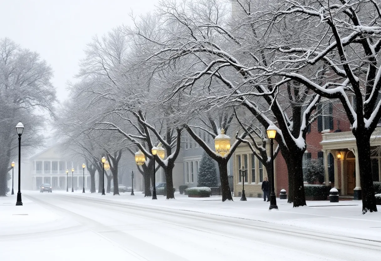
Winter Storm Hits the Lowcountry: What You Need to Know
Attention, residents of the Lowcountry! If you thought winter was just a fairy tale for our region, think again! Get ready for a winter storm that’s set to roll in on January 21, 2025, bringing with it snow and sleet that could leave us all scrambling for our winter gear. This is not a drill; it’s time to prepare!
When to Expect the Storm
The storm warning is officially in effect from 5 p.m. on January 21 until noon on January 22. This warning covers areas including Charleston, Berkeley, Colleton, and Dorchester counties. Higher alert levels are necessary because a cold weather advisory will follow, running until 6 p.m. on January 22. So, listen up! It’s going to be chilly!
Snow and Ice Accumulations
Brace yourselves! Snow and ice accumulations could reach between 1 to 3 inches in various locales. Sounds like the perfect opportunity for some snowball fights, right? But hold your horses! Forecasts predict an impressive 80% chance of rain on January 21, and we might see a mix of winter precipitation to boot!
Temperatures on the Rise (or Drop)
Mark your calendars and get ready for some chill! The expected high on January 21 is only around 39°F, and things are going to get particularly frosty when the temperatures dip down to about 25°F. If that wasn’t enough to send shivers down your spine, wind chills could drop to a brisk 10-15 degrees on the evenings of January 21 and 22. Definitely not ideal weather for a stroll!
Timing and Areas Impacted
For inland communities like Summerville, Moncks Corner, and Walterboro, expect snow to mix with rain between 4 p.m. and 7 p.m. on January 21. Moving closer to the coast, those rain showers will morph into mixed precipitation as the evening rolls in, with snowfall starting overnight. The heaviest snowfall is predicted to hit between 8 p.m. January 21 and 6 a.m. January 22. Pack your hot cocoa, folks!
School Adjustments
With the storm making its way in, local schools are also doing their part to keep our kids safe. Many districts are adjusting their schedules. For example:
- Aiken County will dismiss early on January 21.
- Berkeley County has planned for a half-day on January 21 and will move to virtual learning on January 22.
- Charleston County School District will release students two hours early on January 21 while canceling all after-school activities, followed by virtual learning on January 22.
Expect many more districts to announce similar actions to keep everyone out of harm’s way.
Community Preparations and Resources
Local officials are not sitting idly by as the storm threatens to sweep through. Charleston County Emergency Management is gearing up to handle icy roads and bridges. Collaborative efforts with the S.C. Department of Transportation are underway to make sure our communities are as prepared as possible. Even the Charleston International Airport is ready with snow and ice removal plans, with staff ready to work around the clock!
What You Should Do
Residents, it’s time to get prepared for what may come our way! With potential travel issues and power outages likely due to snow and sleet accumulations, safety is key. As such, it’s best to limit travel whenever possible. Warming shelters are available to ensure everyone has a cozy, safe place to go—check local listings for specific locations and hours!
Watch Out for Black Ice!
And here’s a heads-up: after the storm, watch for black ice forming as melting snow and ice refreeze overnight. It’s a sneaky hazard we all need to be wary of!
So, as the Lowcountry braces for this winter storm, let’s batten down the hatches and keep our spirits up! Stay warm and safe, and enjoy the snowy wonderland that comes our way!
Deeper Dive: News & Info About This Topic
HERE Resources
Winter Weather Alert: Houston Faces Major Snowstorm
Charleston Prepares for Potential Winter Storm
Charleston Experiences Rare Snow and Ice Storm
Charlotte Prepares for Winter Storm with Duke Energy’s Assistance
Winter Storm Set to Blanket Upstate South Carolina
Winter Storm Blair Set to Impact 1,500 Miles with Snow
Unprecedented Tornado Warning Causes Panic in San Francisco
Holiday Cheer Hits Charleston with a Splash – But Weather Cancels Plans!
Additional Resources

Author: STAFF HERE CHARLESTON
CHARLESTON STAFF WRITER The CHARLESTON STAFF WRITER represents the experienced team at HEREcharleston.com, your go-to source for actionable local news and information in Charleston, Charleston County, and beyond. Specializing in "news you can use," we cover essential topics like product reviews for personal and business needs, local business directories, politics, real estate trends, neighborhood insights, and state news affecting the area—with deep expertise drawn from years of dedicated reporting and strong community input, including local press releases and business updates. We deliver top reporting on high-value events such as the Spoleto Festival USA, Charleston Wine + Food Festival, and the MOJA Festival. Our coverage extends to key organizations like the Charleston Metro Chamber of Commerce and the Charleston Museum, plus leading businesses in tourism and maritime industries that power the local economy such as South Carolina Ports Authority and the Charleston Visitor Center. As part of the broader HERE network, including HEREaiken.com, HEREbeaufort.com, HEREchapin.com, HEREcharleston.com, HEREclinton.com, HEREcolumbia.com, HEREgeorgetown.com, HEREgreenwood.com, HEREgreenville.com, HEREhiltonhead.com, HEREirmo.com, HEREmyrtlebeach.com, HEREnewberry.com, HERErockhill.com, HEREspartanburg.com, HEREaustin.com, HEREcollegestation.com, HEREdallas.com, HEREhouston.com, and HEREsanantonio.com, we provide comprehensive, credible insights into South Carolina's dynamic landscape.