News Summary
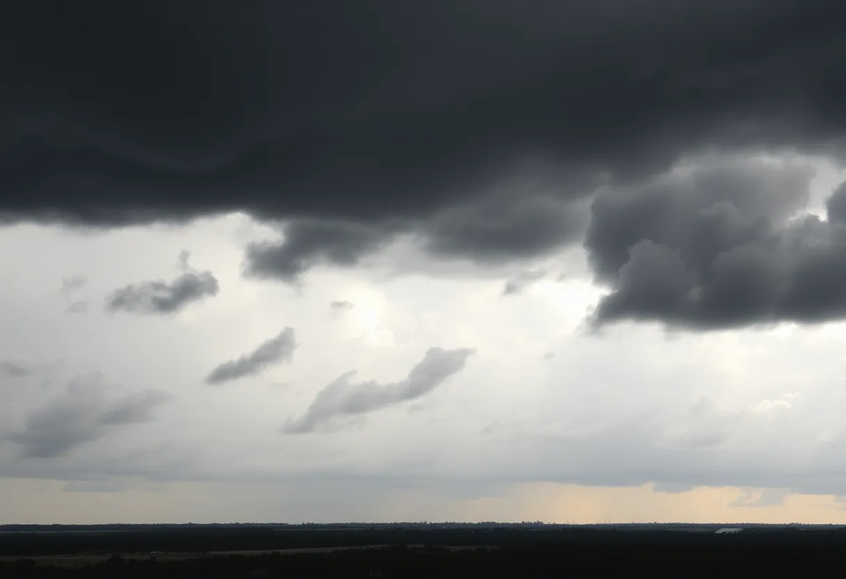
The National Weather Service has issued a severe thunderstorm watch for Charleston County and nearby regions, effective until 9 p.m. The approaching storm is expected to bring wind gusts up to 60 mph, possible small hail, and intense lightning. Affected areas include Charleston Harbor and surrounding counties. Residents are advised to seek shelter and stay informed as conditions can change rapidly. The storm poses risks of damage to property and power outages due to high winds and potential tornadoes.
Charleston – The National Weather Service (NWS) has issued a severe thunderstorm watch for Charleston County and surrounding areas, effective until 9 p.m. for Charleston County and until 10 p.m. for Georgetown and Williamsburg Counties. Severe thunderstorms are advancing from the west, targeting locations along a line stretching from near Hampton Plantation State Park to over Isle of Palms, moving southeast at an impressive speed of 45 mph.
Concerning weather patterns are anticipated as this storm system approaches, with wind gusts potentially reaching up to 60 mph and the possibility of small hail. Radar imagery captured severe thunderstorms at approximately 5:25 p.m. near Branchville, situated 13 miles northwest of Saint George, with those storms proceeding eastward at 35 mph.
Timing and Area of Impact
The severe thunderstorm watch encompasses Charleston Harbor and the Coastal Waters from the South Santee River to Edisto Beach to Savannah, extending out 20 nautical miles. This weather system is projected to arrive at the I-95 corridor, affecting areas in northwestern Colleton, Dorchester, Berkeley Counties, and Beaufort County between 3 p.m. and 5 p.m. The storms are expected to reach Charleston and southeastern Berkeley Counties between 6 p.m. and 8 p.m.
Storm Severity and Risks
The Storm Prediction Center has classified the storm threat for inland regions of South Carolina as a Level 3 out of 5, indicating a significant risk of severe weather. Along with the strong gusts, there could be substantial damage to roofs, siding, and trees, as well as power outages due to downed lines. Meteorological experts advise that isolated tornadoes cannot be dismissed.
High winds accompanying the storms may pose travel hazards, particularly on bridges, especially for high-profile vehicles. Additionally, the weather service has issued warnings regarding frequent cloud-to-ground lightning associated with the storms.
Safety Recommendations
Residents in the affected areas are strongly encouraged to seek shelter in well-built structures and to steer clear of windows as the storm approaches. Staying informed through reliable channels is also advised as conditions can change rapidly.
Current Weather Conditions and Forecast
The ongoing storms are part of a larger weather pattern that includes scattered thunderstorms, with a 50% chance of rainfall. The temperature is expected to peak at 86°F with southwesterly winds ranging from 10 to 20 mph. As night approaches, a low of around 75°F is anticipated, with ongoing thunderstorms primarily before midnight and a 40% chance of rain continuing through the night.
Residents are urged to remain vigilant and prepared as these severe weather conditions approach. Awareness of the storm’s potential impact is crucial for safety and readiness in the face of possible disruptions.
Deeper Dive: News & Info About This Topic
HERE Resources
Severe Weather Action in Texas as Emergency Resources Mobilized
South Carolina Battles Widespread Wildfires Amid Emergency
Tropical Storm Debby Causes Severe Flooding in Charleston
Severe Thunderstorms and Record Rainfall Lead to Flooding in Charleston, SC
Eggs Up Grill Expands to James Island
Weekend of Heavy Rain and Cultural Events in Charleston
Severe Thunderstorms Cause Major Flooding in Charleston
South Carolina Faces Disappointing First Snowfall of 2024
Wildfires Rage in South Carolina, Prompting Emergency Measures
Severe Thunderstorm Alert Issued for Charleston Area
Additional Resources
- Live 5 News
- Wikipedia: Thunderstorm
- Count on 2 Weather
- Google Search: Severe Weather Forecast
- ABC11 Weather
- Encyclopedia Britannica: Weather
- WYFF4 News
- Google News: Thunderstorms

Author: STAFF HERE CHARLESTON
The CHARLESTON STAFF WRITER represents the experienced team at HEREcharleston.com, your go-to source for actionable local news and information in Charleston, Charleston County, and beyond. Specializing in "news you can use," we cover essential topics like product reviews for personal and business needs, local business directories, politics, real estate trends, neighborhood insights, and state news affecting the area—with deep expertise drawn from years of dedicated reporting and strong community input, including local press releases and business updates. We deliver top reporting on high-value events such as the Spoleto Festival USA, Charleston Wine + Food Festival, and the MOJA Festival. Our coverage extends to key organizations like the Charleston Metro Chamber of Commerce and the Charleston Museum, plus leading businesses in tourism and maritime industries that power the local economy such as South Carolina Ports Authority and the Charleston Visitor Center. As part of the broader HERE network, including HEREaiken.com, HEREbeaufort.com, HEREchapin.com, HEREcharleston.com, HEREclinton.com, HEREcolumbia.com, HEREgeorgetown.com, HEREgreenwood.com, HEREgreenville.com, HEREhiltonhead.com, HEREirmo.com, HEREmyrtlebeach.com, HEREnewberry.com, HERErockhill.com, HEREspartanburg.com, HEREaustin.com, HEREcollegestation.com, HEREdallas.com, HEREhouston.com, and HEREsanantonio.com, we provide comprehensive, credible insights into South Carolina's dynamic landscape.